The Canvas of Antiquity
Long before modern borders were drawn with ink and rulers, the map of Palestine was defined by its topography and its role as a land bridge between continents. From the Galilee mountains in the north to the Negev desert in the south, and from the Mediterranean Sea to the Jordan River, the land was a tapestry of olive groves, terraced hills, and ancient cities.
Under the Ottoman Empire, the region was organized into various administrative districts (sanjaks). There was no single “political” border in the modern sense, but the cultural and social map was incredibly dense. It was a map of interconnected villages, seasonal harvest routes, and bustling urban centers like Jerusalem, Jaffa, and Gaza. The map of this era was defined by the Tabu—the land registry—where families tracked their ownership of almond trees and wheat fields through generations.
The Lines of Partition
The 20th century transformed the Palestinian map from a fluid cultural landscape into a contested political one. Following World War I and the fall of the Ottoman Empire, the British Mandate established formal borders. However, the most seismic shift occurred in 1947 with UN Resolution 181, which proposed partitioning the land into two states.
This period introduced the “Green Line,” a demarcation that would come to define the geopolitical discourse for decades. For Palestinians, this era is marked by the Nakba (the Catastrophe) of 1948. The map changed overnight: hundreds of villages were depopulated or destroyed, and names that had existed for centuries were replaced. The physical map became a tool of erasure, while the mental map of the refugees—the “map of return”—became a sacred heirloom, often symbolized by the iron keys to homes that no longer appeared on official modern atlases.
A Fragmented Reality
Following the 1967 war, the map underwent further transformation. The West Bank, Gaza Strip, and East Jerusalem were occupied, leading to a landscape defined by fragmentation. The Oslo Accords of the 1990s introduced a complex alphabet soup of jurisdictions:
-
Area A: Full Palestinian civil and security control.
-
Area B: Palestinian civil control and Israeli security control.
-
Area C: Full Israeli civil and security control.
This created a “Swiss cheese” map—a series of disconnected islands (enclaves) separated by checkpoints, bypass roads, and a separation wall. For a Palestinian traveler, the map is not measured in kilometers, but in hours spent at barriers. It is a map where the distance between two cities might be ten miles on paper but a lifetime of permits and walls in reality.
Symbols of the Soil
Because the physical map is so heavily contested and fragmented, Palestinians have turned the map itself into a potent cultural symbol. You see it everywhere:
-
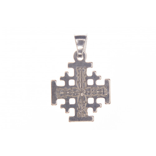
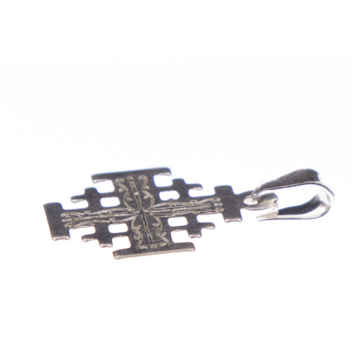
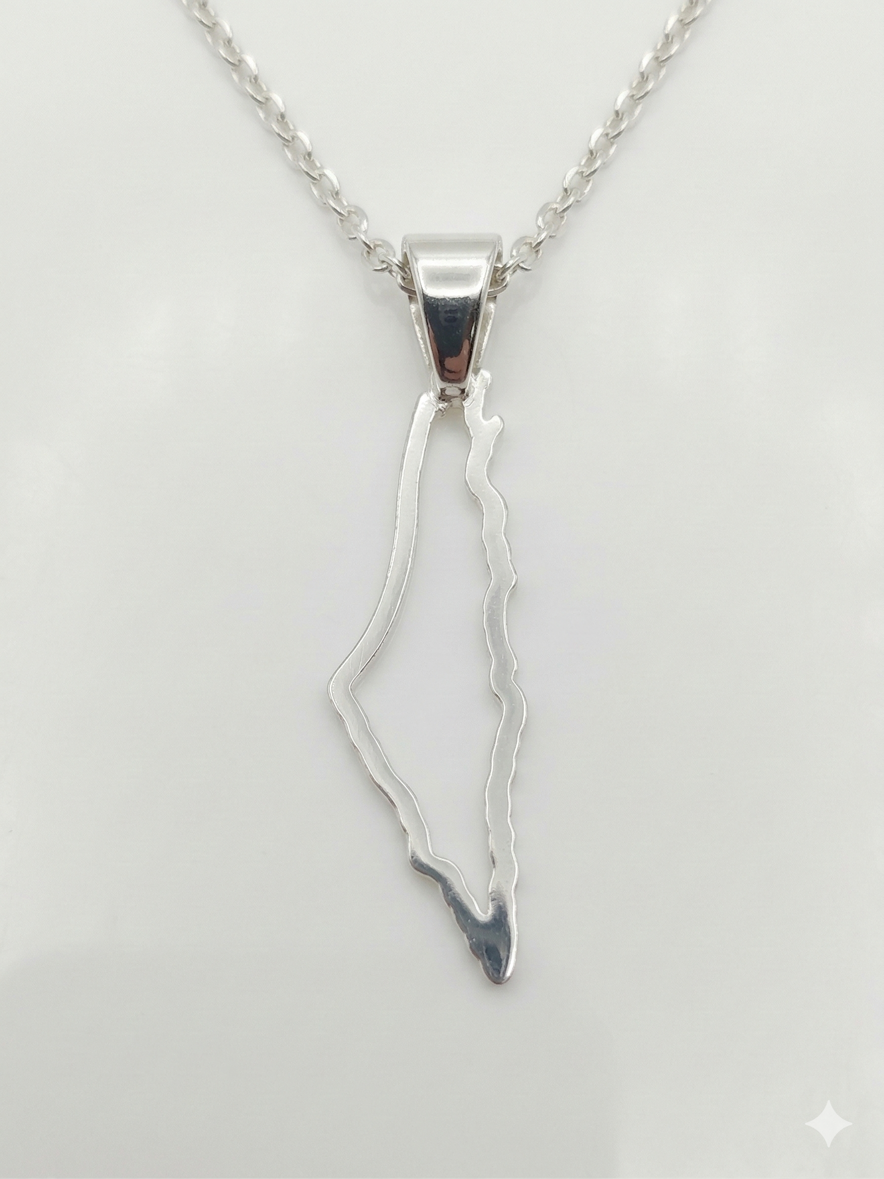
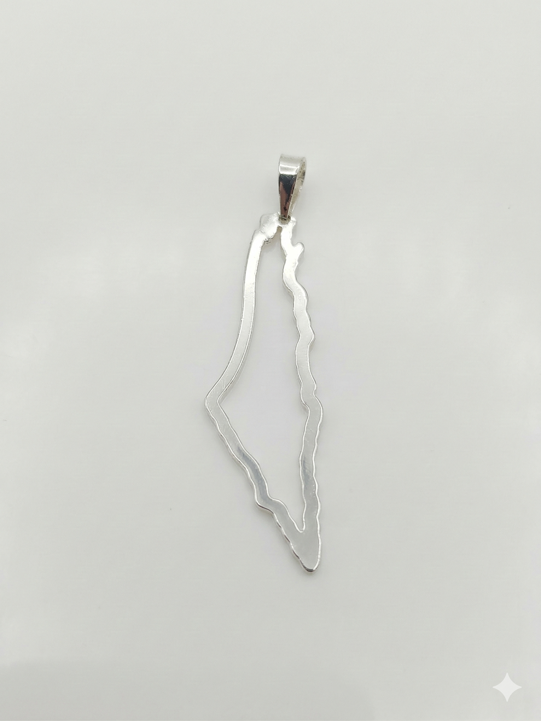
The Pendant: A slender, vertical silhouette of the land, worn in silver or gold around the neck.
-
The Embroidery: In Tatreez (traditional needlework), the patterns of the map are woven into dresses, each stitch representing a specific village or region—the oranges of Jaffa, the grapes of Hebron.
-
Art and Literature: From the poems of Mahmoud Darwish to the cartoons of Naji al-Ali, the map is a character in its own right. It is often depicted as a person, a root, or a wound.
The Digital and Modern Map
In the 21st century, the struggle over the map has moved to the digital realm. Palestinians have fought for recognition on global platforms like Google Maps and Apple Maps, where village names or even the name “Palestine” itself have often been omitted or labeled controversially.
In response, Palestinian mappers and activists have engaged in “counter-mapping.” Projects like Visualizing Palestine use data to show the reality of water rights, land loss, and movement restrictions. These modern maps serve as a digital archive, ensuring that even if a village is physically gone, its coordinates and history remain accessible to the world.
Conclusion: The Map in the Heart
The story of the Palestinian map is far from over. It is a map that refuses to be static. While political borders may shift and walls may rise, the “social map”—the connections between families in Ramallah, Gaza, and the diaspora in Chile or Jordan—remains unbroken.
Ultimately, for the designer, the artisan, and the refugee, the map is more than geography. It is an assertion of existence. As long as the silhouette of the land is drawn, carved in silver, or stitched into fabric, the story of the land remains alive, waiting for a time when the lines on the paper finally match the freedom of the people on the ground.